Applying geoscience to Australia's most important challenges
Geoscience Australia provides web services for public use that allow access to our data without having to store datasets locally. Geoscience Australia supports a variety of web service protocols, including Open Geospatial Consortium (OGC) services and ESRI mapping and image services.
Filter Tool
To filter services based on capability, use the options below, or use the search function to find specific services.
ESRI:ArcGIS:MapServer | OGC:WMS
The annual offshore petroleum exploration acreage release is part of the government’s strategy to promote offshore oil and gas exploration. Each year, the government invites companies to bid for the opportunity to invest in oil and gas exploration in Australian waters. The 2020 acreage release consists of 42 areas offshore of the Northern Territory, Western Australia, Victoria and the Ashmore and Cartier Islands.
ESRI:ArcGIS:MapServer | OGC:WMS
The 2021 Offshore Greenhouse Gas Storage Acreage Release is a key strategy of the Australian Government to reduce emissions and support Australia's resource sector. The GHG acreage release will provide companies the opportunity to explore for offshore carbon dioxide injection and storage locations. The 2021 GHG acreage release consists of 5 areas across the Bonaparte, Browse and Northern Carnarvon Basins.
OGC:WMS | ESRI:ArcGIS:MapServer
The annual offshore petroleum exploration acreage release is part of the government’s strategy to promote offshore oil and gas exploration. Each year, the government invites companies to bid for the opportunity to invest in oil and gas exploration in Australian waters. The 2021 acreage release consists of 21 areas offshore of Western Australia, Victoria, Tasmania and the Ashmore and Cartier Islands.
ESRI:ArcGIS:MapServer | OGC:WMS
The annual offshore petroleum exploration acreage release is part of the government’s strategy to promote offshore oil and gas exploration. Each year, the government invites companies to bid for the opportunity to invest in oil and gas exploration in Australian waters. The 2022 acreage release consists of 10 areas offshore of the Northern Territory, Western Australia, Victoria, and the Ashmore and Cartier Islands.
ESRI:ArcGIS:MapServer | OGC:WMS
The 2023 Offshore Greenhouse Gas Storage Acreage Release is a key strategy of the Australian Government to reduce emissions and support Australia's resource sector. The GHG acreage release will provide companies the opportunity to explore for offshore carbon dioxide injection and storage locations. The 2023 GHG acreage release consists of 10 areas across the Bonaparte, Browse, Northern Carnarvon Basins, Perth, Otway, Bass and Gippsland Basins.
ESRI:ArcGIS:MapServer | OGC:WMS
This web map service provides visualisations of datasets prepared for the Technology Investment Roadmap Data Portal. The service has been developed using various mineral deposit, mine location and industrial plant location datasets sourced from the Australia’s Identified Mineral Resources (2019), produced by Geoscience Australia (http://dx.doi.org/10.11636/1327-1466.2018)
The AMSIS Distance To tool calculates the distance to a selected marine feature. The output is the distance to the nearest feature from the given location.
OGC:WMS | ESRI:ArcGIS:MapServer
The data contained in this service is not authoritative and has not been updated since 2006. This web service contains the legacy data found in the Australian Marine Spatial Information System (AMSIS) between 2006 and 2015, with a currency date of 2006. To honour the original licensing arrangements with the data holders, only the WMS is available. Users will need to contact the agency responsible for the data to check current validity and spatial...
OGC:WMTS | ESRI:ArcGIS:MapServer
This web service shows areas or locations occupied by an existing high-density urban development or known individual building structures in peri-urban and remote locations. Data used in this service is of varying levels of coverage and quality since it is aggregated from a variety of sources. The intended purpose of the service is to provide preliminary, first-pass information about urban environment, building structures and their distribution i...
OGC:WMS | ESRI:ArcGIS:ImageServer
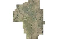
AUSIMAGE Aerial Imagery Canberra 2014 is a web service of high resolution aerial imagery (10 cm to 18 cm) over Canberra and Queanbeyan, acquired in February and April 2014. AUSIMAGE Aerial Imagery is a data product of Jacobs Group (Australia) Pty Ltd, released by Geoscience Australia as a web map service under license agreement.
OGC:WMS | ESRI:ArcGIS:MapServer
This is the Acreage Release Marine Environmental Data compiled web service to be updated each year with acreage release. It contains the following publicly available datasets, for the 2016 Acreage Release - Marine Survey Towed-video Transects, Marine Sediments Database Samples, Australian Seascapes, Seabed Mud Content on the Northwest Shelf, Seabed Sand Content of the Northwest Shelf and Seabed Gravel Content of the Northwest Shelf.
ESRI:ArcGIS:MapServer | OGC:WMS
This web service shows the spatial locations of potential CO2 storage sites that are at an advanced stage of characterisation and/or development. The areas considered to be at an advanced stage are parts of the Cooper Basin in central Australia, a portion of the Surat Basin (Queensland), the offshore Gippsland Basin (Victoria), where the CarbonNet Project is currently at an advanced stage of development and the Petrel Sub-basin. This service will...
OGC:WFS | ESRI:ArcGIS:MapServer | OGC:WMS
The Archean alkaline and related igneous rocks of Australia web map service depicts the spatial representation of the alkaline and related rocks of Archean age. All are from the Pilbara and Yilgarn Cratons of Western Australia.
This service presents the outgoing data services from the AusSeabed Coordination Tool. The Coordination tool provides two data services, the Upcoming Survey information layer and the National Priorities information layer. Upcoming Survey Layer This layer presents the extents of planned surveys that will be undertaken in the coming years within the Australian maritime region. The purpose of this web service is to broadcast information about upco...
ESRI:ArcGIS:MapServer | OGC:WFS | OGC:WMS
This service contains the limit and extent of Section 3 of the Coastal Waters (State Powers) Act 1980, and the Coastal Waters (Northern Territories Powers) Act 1980. NOTE: the Polygon depicting the area of the coastal waters is not constrained on the landward side. The polygon includes areas that fall within the constitutional limits of the States. When information depicting the landward constitutional limit of the States becomes available, the p...
ESRI:ArcGIS:MapServer | OGC:WFS | OGC:WMS
This service contains features as defined under the Offshore Petroleum and Greeenhouse Gas Storage Act 2006. The Petroleum blocks defined under the Act, are delivered separately in the 'Australia - OPGGSA 2006 - Petroleum Blocks' service.
Not current – This service has been deprecated in favor of the 2019 epoch, which includes amendments reflecting new boundary arrangements with Timor-Leste, which came into force on 30 August 2019. The Seas and Submerged Lands Act (SSLA) is the Australian legislation that provides the framework for Australia to declare the baselines, limits and zones provided under the first six parts of the United Nations Convention on the Law of the Sea. These ...
Not current – This service has been deprecated in favor of the 2019 epoch, which includes amendments reflecting new boundary arrangements with Timor-Leste, which came into force on 30 August 2019. The Seas and Submerged Lands Act (SSLA) is the Australian legislation that provides the framework for Australia to declare the baselines, limits and zones provided under the first six parts of the United Nations Convention on the Law of the Sea. These ...
OGC:WFS | ESRI:ArcGIS:MapServer | OGC:WMS
Australia's Land Borders is a product within the Foundation Spatial Data Framework (FSDF) suite of datasets. It is endorsed by the ANZLIC – the Spatial Information Council and the Intergovernmental Committee on Surveying and Mapping (ICSM) as the nationally consistent representation of the land borders as published by the Australian states and territories. It is topologically correct in relation to published jurisdictional land borders and the Ge...
ESRI:ArcGIS:MapServer | OGC:WMS | OGC:WCS
The Australian Bathymetry and Topography web service includes the topography of Australia and the bathymetry of the adjoining Australian Exclusive Economic Zone. The area selected does not include data from Australia's marine jurisdiction offshore from the Territory of Heard and McDonald Islands and the Australian Antarctic Territory. The 2009 bathymetry data were compiled by Geoscience Australia from multibeam and single beam data, and along wit...
OGC:WFS | OGC:WMS | ESRI:ArcGIS:MapServer | OGC:WMTS
The service contains the Australian Coastal Geomorphology Environments, used to support a national coastal risk assessment. It describes the location and extent primary geomorphological environments (both dispositional and erosional) present along the Australia coast and the processes acting on the features within. It is cached service with a Web Mercator Projection.
OGC:WFS | OGC:WMS | ESRI:ArcGIS:MapServer | OGC:WMTS
The service contains the Australian Coastal Geomorphology Landform Subtype Classifications, used to support a national coastal risk assessment. It describes the location and extent of landform subtypes identifiable at scales between 1:25,000 and 1:10,000. It also provides further detail to the Landform Type, with particular reference to feature stability (e.g. dune types) and mobility (e.g. channel types). It is cached service with a Web Mercator...
OGC:WMTS | OGC:WMS | OGC:WFS | ESRI:ArcGIS:MapServer
The service contains the Australian Coastal Geomorphology Scale Guide, used to support a national coastal risk assessment. It includes the extents of various reclassified costal mapping products. It is cached service with a Web Mercator Projection.
ESRI:ArcGIS:MapServer | OGC:WMS
The service contains the Australian Coastal Geomorphology Smartline, used to support a national coastal risk assessment. The 'Smartline' is a representation of the geomorphic features located within 500m of the shoreline, denoted by the high water mark. The service includes geomorphology themes and stability classes.
ESRI:ArcGIS:MapServer | OGC:WMS | OGC:WFS
The Australian Coastal Sediment Compartments Web Service provide a hierarchical spatial classification relevant to the assessment of sediment movement in the Australian coastal zone, and represent a tool to assist coastal planning and management. Additional spatial data layers produced during the development of the compartments are provided for reference.
Australian Community Climate and Earth-System (ACCESS) Numerical Weather Prediction (NWP) data is made available by the Bureau of Meteorology for registered subscribers such as GA. ACCESS-C3 (City) model is a forecast-only model performed every 6 hours and consists of grid coordinates covering domains around Sydney, Victoria and Tasmania, Brisbane, Perth, Adelaide and Darwin. ACCESS Impact Modelling (ACCESS-IM) System utilise information from ACC...
ESRI:ArcGIS:MapServer | OGC:WFS | OGC:WMS
This web map service provides the locations and status, as at 30 June 2020, of Australian operating mines, mines under development, mines on care and maintenance and resource deposits associated with critical minerals. Developing mines are deposits where the project has a positive feasibility study, development has commenced or all approvals have been received. Mines under care and maintenance and resource deposits are based on known resource es...
OGC:WFS | ESRI:ArcGIS:MapServer | OGC:WMS
The Australian Geological Provinces Database contains descriptions and spatial extents of the fundamental geological elements of the Australian continent and offshore surrounds. Province types include sedimentary basins, tectonic provinces such as cratons and orogens, igneous provinces, and metallogenic provinces. Spatial data has been captured largely at approximately 1:1M scale for intended use between 1:2M and 1:5M scale.
This service provides header and observation data for gravity stations located throughout continental Australia and Remote Offshore Territories. Data sources include the Australian National Gravity Database (ANGD) and the Australian Fundamental Gravity Network (AFGN) maintained by Geoscience Australia (GA). Data has been obtained by Surveyors, Commonwealth and state/territory Governments, private companies, and educational institutions. Gravity...
OGC:WFS | ESRI:ArcGIS:MapServer | OGC:WMS
This web service features Australian hydrogen projects that are actively in the investigation, construction, or operating phase, and that align with green hydrogen production methods as outlined in Australia's National Hydrogen Strategy. The purpose of this dataset is to provide a detailed snapshot of hydrogen activity across Australia, and includes location data, operator/organisation details, and descriptions for all hydrogen projects listed.
OGC:WMTS | OGC:WMS | ESRI:ArcGIS:MapServer
The Land Cover map service includes information derived from the Dynamic Land Cover Dataset (2000-2008) containing Enhanced Vegetation Index (EVI) information. The service provides a base-line for identifying and reporting on change and trends in vegetation cover and extent. It is a cached service with a Web Mercator Projection.
This OGC conformant web service delivers data from Geoscience Australia's Boreholes database (borehole header and directional survey data) and associated geological observations (lithostratigraphic data). The data includes records of boreholes drilled by Geoscience Australia and its predecessor organisations (BMR, AGSO), all boreholes drilled in Australian Commonwealth offshore marine jurisdictions, and a selection of onshore boreholes drilled by...
OGC:WMS | ESRI:ArcGIS:MapServer | OGC:WFS
This web map service shows the location and status of Australian operating mines, mines under development and mines under care and maintenance. Developing mines are deposits where the project has a positive feasibility study, development has commenced or all approvals have been received. Mines under care and maintenance have known resource estimations and may be mined or developed in the future.
OGC:WMTS | OGC:WMS | ESRI:ArcGIS:MapServer
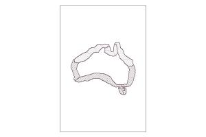
The service includes an outline of the Australian shoreline. The information was derived from the Geodata 3 Topographic 250K 2007 data, with a nominal scale of 1:250,000. It is a cached service with a Web Mercator Projection.
This web service provides access to the Australian Stratigraphic Units Database (ASUD), the national authority on stratigraphic names in Australia. The database is maintained by Geoscience Australia on behalf of the Australian Stratigraphy Commission, a standing committee of the Geological Society of Australia. Where possible this service conforms to the GeoSciML v4.1 data transfer standard.
OGC:WFS | OGC:WMS | ESRI:ArcGIS:MapServer
The Australian Submarine Canyons service identifies the location of 753 submarine canyons surrounding mainland Australia and its external territories, with associated metrics.
OGC:WFS | ESRI:ArcGIS:MapServer | OGC:WMS | OGC:WMTS
This service provides Australian surface hydrology, including natural and man-made features such as water courses (including directional flow paths), lakes, dams and other water bodies. The information was derived from the Surface Hydrology database, with a nominal scale of 1:250,000. The National Basins and Catchments are a national topographic representation of drainage areas across the landscape. Each basin is made up of a number of catchments...
ESRI:ArcGIS:MapServer | OGC:WMTS
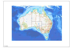
The Australian Topographic base map service is seamless national dataset coverage for the whole of Australia. The map is a representation of the Geoscience Australia 250k topographic specification and portrays a detailed graphic representation of features that appear on the Earth's surface. These features include cultural, hydrography and relief themes. The service contains layer scale dependencies.
The Barest Earth Sentinel-2 Map Index web map service depicts the 1 to 250 000 maps sheet tile frames that have been used to generate individual tile downloads of the Barest Earth Sentinel-2 product. This web service is designed to be used in conjunction with the Barest Earth Sentinel-2 web service to provide users with direct links for imagery download.
OGC:WMS | ESRI:ArcGIS:MapServer
The National Bathymetry Derivatives Map of Australia Web Map Service contains national scale bathymetric derivatives - hillshaded bathymetry and topography, slope, aspect, topographic relief and topographic rugosity, which are available for download on Geoscience Australia's website. These bathymetric derivatives have been derived from the Australian Bathymetry and Topography Grid, June 2009. Each dataset is gridded to 9 arc second resolution (i....
ESRI:ArcGIS:MapServer | OGC:WMS
This web map service provides visualisations of in-service, large-scale battery installations connected to the National Energy Market (NEM) power system in eastern and south-eastern Australia. Data compiled from the Australian Energy Market Operator (AEMO).
IMPORTANT NOTICE: This web service has been deprecated. The Australian Onshore and Offshore Boreholes OGC service at https://services.ga.gov.au/gis/boreholes/ows should now be used for accessing Geoscience Australia borehole data. This is an Open Geospatial Consortium (OGC) web service providing access to a subset of Australian geoscience samples data held by Geoscience Australia. The subset currently relates specifically to Australian B...
OGC:WMS | OGC:WCS | ESRI:ArcGIS:MapServer
This web service displays the results of a marine survey conducted by Geoscience Australia in Commonwealth waters of the north-eastern Browse Basin (Caswell Sub-basin) between 9 October and 9 November 2014. The additional codes GA-0345 and GA-0346 refer to Geoscience Australia (GA) internal codes and TAN1411 is the vessel survey number given by the RV Tangaroa for 2014.
OGC:WMS | ESRI:ArcGIS:MapServer
The Carbon Infrastructure Assessment and Planning (CIAP) Tile Index System is a set of nested tile indexes from 1:25000 through to 1:10000000 scales based on the ICSM map indexes. The product has been generated for use at national scale based in GDA94 projection. This product supports the best available information system (BAIS)as used by the CIAP application.
This service is designed to be used within the Carbon Capture and Storage application for a 3D visual representation. It is an elevation service that represents 800m below the Digital Elevation Model (DEM) Shuttle Radar Topography Mission (SRTM) 1 Second over Australian Bathymetry Topography service. This is used as a basic gauge as to determine where CO2 should have enough pressure to be converted into a super fluid.
OGC:WMS | ESRI:ArcGIS:MapServer
This service will be decommissioned on 31/8/2022 and will not be replaced. This polygon dataset contains the sedimentary basins of Australia ranked by their CO2 storage potential. See the National Carbon Mapping and Infrastructure Plan Australia report for details.
OGC:WMS | OGC:WCS | ESRI:ArcGIS:MapServer
This web service contains the Casey Station Bathymetry survey that displays one seamless bathymetry grid of 1m resolution. The GA-0348 survey, acquired by Geoscience Australia, Royal Australian Navy and Australian Antarctic Division (AAD) on-board the Research Vessel Howard Burton from the 23rd of December 2014 to the 27th of January 2015. Further details of the data lineage can be found with the associated database.
ESRI:ArcGIS:MapServer | OGC:WCS | OGC:WMS
This web service combines two surveys GA-4415 and GA-0348. The Casey Station Bathymetry survey displays one seamless bathymetry grid of 1m resolution. Further details of the data lineage can be found with the associated database. This web service is published with the permission of the CEO, Geoscience Australia.
OGC:WMS | OGC:WFS | ESRI:ArcGIS:MapServer
The Cenozoic alkaline and related igneous rocks of Australia web map service depicts the spatial representation of the alkaline and related rocks of Cenozoic age.
The Clip and Zip tool takes an input polygon extent as WKT input and clips required featureclasses listed. The data is referenced from its own database with all layers projected to 4326 spatial reference. The output is a zipped file geodatabase with a copyright text file included.
This web feature service delivers geochemical data for samples analysed both for inorganic and organic geochemistry. Analytical data are sourced from Geoscience Australia's Inorganic Geochemistry Database (OZCHEM) and Organic Geochemistry Database (ORGCHEM), respectively. The data are joined on a unique sample number. Inorganic geochemical data cover the majority of the periodic table, with metadata on analytical methods and detection limits. Org...
The Criteria Assessment tool takes the input path or area created by the user and the input variables chosen to generate a heat map surface, KML surface, KMZ surface and PDF Report. This service is specifically for use within the Carbon Capture and Storage application.
OGC:WMS | ESRI:ArcGIS:MapServer
This service is the processing inputs that are used within the Criteria Assessment geoprocessing service. This service is specifically for use within the Carbon Capture and Storage application.
This web service delivers datasets produced by the Critical Minerals Mapping Initiative (CMMI), a collaboration between Geoscience Australia (GA), the Geological Survey of Canada (GSC) and the United States Geological Survey (USGS). Data in this service includes geochemical analyses of over 7000 samples collected from or near mineral deposits from 60 countries, and mineral prospectivity models for clastic-dominated (Zn, Pb) and Mississippi Valley...
OGC:WCS | ESRI:ArcGIS:ImageServer | OGC:WMS
The DMCii Mosaic service presents a sample of imagery captured by UK2-DMC satellite between December 2011 and April 2012.
The Digital Earth Australia Hotspots web service has been developed as part of the Digital Earth Australia Hotspots national bushfire monitoring system. The service delivers hotspot data derived from (a growing number of) satellite-born instruments that detect light in the thermal wavelengths. The colour of the spot represents the time the Hotspot was last observed by a passing satellite (e.g. 0-2 hours). The colour does not indicate severity. Ty...
ESRI:ArcGIS:MapServer | OGC:WCS | OGC:WMS
This service represents a combination of two data products, the DEM_SRTM_1Second dataset and the Australian_Bathymetry_Topography dataset. This service was created to support the CO2SAP (Co2 Storage application) Project to create a transect elevation graph within the application. This data is not available as a dataset for download as a Geoscience Australia product. The DEM_SRTM_1Second service represents the National Digital Elevation Model (DE...
OGC:WCS | OGC:WMS | ESRI:ArcGIS:MapServer
This Service represents the 25 metre Digital Elevation Model (DEM), with national coverage. It is derived from merged LiDAR and various projects. New data will be added to the service as it becomes available.
OGC:WCS | OGC:WMS | ESRI:ArcGIS:MapServer
This Service represents the 5 metre Digital Elevation Model (DEM), with national coverage. It is derived from merged LiDAR and various projects. New data will be added to the service as it becomes available.
ESRI:ArcGIS:MapServer | OGC:WCS | OGC:WMS
This service represents the National Digital Elevation Model (DEM) 1 Second Smoothed Aspect product, derived from the National Smoothed Digital Elevation Model SRTM 1 Second. Aspect measures the direction in which a land surface slope faces. The direction is expressed in degrees from north.
OGC:WCS | OGC:WMS | ESRI:ArcGIS:MapServer
This service represents the National Digital Elevation Model (DEM) 1 Second Percentage Slope product, derived from the National DEM SRTM 1 Second. Slope measures the inclination of the land surface from the horizontal. Percent slope represents this inclination as the ratio of change in height to distance.
OGC:WCS | OGC:WMS | ESRI:ArcGIS:MapServer
This Service represents the National DEM 1 Second Hydrologically Enforced product derived from the National DEM SRTM 1 Second and National Watercourses, lakes and Reservoirs
OGC:WCS | OGC:WMS | ESRI:ArcGIS:MapServer
This service represents the National Digital Elevation Model (DEM) 1 Second product derived from the National DEM SRTM 1 Second. The DEM represents ground surface topography, with vegetation features removed using an automatic process supported by several vegetation maps.
OGC:WMS | ESRI:ArcGIS:MapServer
This service has been created specifically for display in the National Map and the chosen symbology may not suit other mapping applications. The Australian Topographic map service is seamless national dataset coverage for the whole of Australia. These data are best suited to graphical applications. These data may vary greatly in quality depending on the method of capture and digitising specifications in place at the time of capture. The web map s...
OGC:WMS | ESRI:ArcGIS:MapServer
This service has been created specifically for display in the National Map and the chosen symbology may not suit other mapping applications. The Australian Topographic web map service is seamless national dataset coverage for the whole of Australia. These data are best suited to graphical applications. These data may vary greatly in quality depending on the method of capture and digitising specifications in place at the time of capture. The web m...
OGC:WMS | ESRI:ArcGIS:MapServer
This service has been created specifically for display in the National Map and the symbology displayed may not suit other mapping applications. The service includes natural and man-made surface hydrology features, such as water courses (including directional flow paths), lakes, dams and other water bodies and marine themes. The data is sourced from Geoscience Australia 250K Topographic data and Surface Hydrology data. The service contains layer ...
OGC:WMS | ESRI:ArcGIS:MapServer
This service has been created specifically for display in the National Map and the symbology displayed may not suit other mapping applications. Information included within the service includes the linear locations for surface hydrology, including natural and man-made features such as water courses (including directional flow paths), lakes, dams and other water bodies and marine themes. The data is sourced from Geoscience Australia 250K Topograph...
ESRI:ArcGIS:MapServer | OGC:WMS
This service has been created specifically for display in the National Map and the symbology displayed may not suit other mapping applications. Information included within the service includes the point locations for surface hydrology, including natural and man-made features such as water courses (including directional flow paths), lakes, dams and other water bodies and marine themes. The data is sourced from Geoscience Australia 250K Topographi...
ESRI:ArcGIS:MapServer | OGC:WMS
This service has been created specifically for display in the National Map and the symbology displayed may not suit other mapping applications. Information included within the service includes the polygon/area locations for surface hydrology, including natural and man-made features such as water courses (including directional flow paths), lakes, dams and other water bodies and marine themes. The data is sourced from Geoscience Australia 250K Top...
This service has been created specifically for display in the National Map and the chosen symbology may not suit other mapping applications. These data are best suited to graphical applications. These data may vary greatly in quality depending on the method of capture and digitising specifications in place at the time of capture. The Australian Topographic web map service is seamless national dataset coverage for the whole of Australia. The map p...
OGC:WMS | ESRI:ArcGIS:MapServer
This service has been created specifically for display in the National Map and the chosen symbology may not suit other mapping applications. The Australian Topographic web map service is seamless national dataset coverage for the whole of Australia. These data are best suited to graphical applications. These data may vary greatly in quality depending on the method of capture and digitising specifications in place at the time of capture. The web m...
OGC:WMS | ESRI:ArcGIS:MapServer
This service has been created specifically for display in the National Map and the chosen symbology may not suit other mapping applications. The Australian Topographic web map service is seamless national dataset coverage for the whole of Australia. These data are best suited to graphical applications. These data may vary greatly in quality depending on the method of capture and digitising specifications in place at the time of capture. The web m...
This web service contains a selection of remotely sensed raster products used in the Exploring for the Future (EFTF) East Kimberley Groundwater Project. Selected products were derived from LiDAR, Landsat (5, 7, and 8), and Sentinel-2 data. Datasets include: 1) mosaic 5 m digital elevation model (DEM) with shaded relief; 2) vegetation structure stratum and substratum classes; 3) Normalised Difference Vegetation Index (NDVI) 20th, 50th, and 80th p...
OGC:WMS | OGC:WMTS | ESRI:ArcGIS:MapServer
The service contains the 2013 Earthquake Hazard map, as a raster and contours. This map shows the peak ground acceleration (response spectral period of 0.01 seconds) on rock expected for a 500 year return period, in units of g, evaluated for the geometric mean of the horizontal components. The map is the closest in return period and response spectral period to the current earthquake hazard map in the Australian Standard AS1170.4-2007.
ESRI:ArcGIS:MapServer | OGC:WMS
The Exploring for the Future Project Areas web service depicts the spatial extents of project work undertaken as part of Geoscience Australia's $100.5 million initiative dedicated to boosting investment in resource exploration in Australia. Each project area extent has been generated by aggregating all project work sites into an envelope polygon. An indicative spend on each f the projects is also given.
This web service provides links to access pictures and documents for any geological or geophysical feature data that are delivered by complementary feature services for these data, including but not limited to: boreholes, field sites, structures, stratigraphic units, samples, mines, mineral deposits and mineral occurrences, along with descriptions of those objects.
OGC:WMS | OGC:WFS | ESRI:ArcGIS:MapServer
This web service provides access to the Major Power Stations, Transmission Substations and Electricity Transmission Lines datasets. These datasets present the spatial locations of all known features in Australia.
OGC:WFS | ESRI:ArcGIS:MapServer | OGC:WMS
This web service provides access to the Foundation Facilities Points dataset. This contains the spatial location of publicly available data showing private and public hospitals, aged care facilities, education facilities and emergency management facilities.
OGC:WFS | OGC:WMS | ESRI:ArcGIS:MapServer
This web service provides access to the Foundation Rail Infrastructure dataset. This contains the spatial locations and attributes of Railway lines and Railway Station points.
OGC:WMS | OGC:WMTS | ESRI:ArcGIS:MapServer
The Surface Geology web map service provides two seamless national coverages of Australian bedrock and surficial geology, compiled at 1:1 million scale (displays only at scales less than 1:1500000), and 1:2.5 million scale (displays only at scales greater than 1:1500000). It also contains 1:5 million scale geological regions and metamorphic geology. The service represents outcropping or near-outcropping bedrock units, and unconsolidated or poorl...
ESRI:ArcGIS:MapServer | OGC:WFS | OGC:WMS
This web service depicts potential geological sequestration sites and has been compiled as part of the Australian Petroleum Cooperative Research Centre's GEODISC program (1999-2002).
ESRI:ArcGIS:MapServer | OGC:WFS | OGC:WMS
The Australian Gazetteer service provides authoritative information on the location, and spelling of approved place names. The Australian Gazetteer is a subset of information held by the relevant State, Territory and Commonwealth naming authorities. Additional authoritative information has also been sourced from the Australian Hydrographic Service, Australian Antarctic Division and Geoscience Australia.
OGC:WFS | OGC:WMTS | OGC:WMS | OGC:WCS
This web service provides access to the Geoscience Australia (GA) ISOTOPE database containing compiled age and isotopic data from a range of published and unpublished (GA and non-GA) sources. The web service includes point layers (WFS, WMS, WMTS) with age and isotopic attribute information from the ISOTOPE database, and raster layers (WMS, WMTS, WCS) comprising the Isotopic Atlas grids which are interpolations of the point located age and isotope...
This web service delivers geological observations and sample descriptions from field sites associated with GA's geological mapping surveys in Australia and Antarctica. Descriptions include information on lithology, stratigraphic units, alteration, structural measurements, and many other geological attributes. Where possible this service conforms to the GeoSciML version 4.1 data standard.
ESRI:ArcGIS:MapServer | OGC:WMS | OGC:WFS
The Stillwell Hills region comprises granulite-facies gneisses which record evidence for multiple episodes of deformation and metamorphism spanning more than 2500 million years. The predominant orthogneiss package (Stillwell Orthogneiss) is thought to represent the margin of an Archaean craton exposed in Enderby Land, some 150 km to the west that was reworked during the late Proterozoic. Younger additions to the crust include Palaeoproterozoic ch...
OGC:WFS | ESRI:ArcGIS:MapServer | OGC:WMS
The Geology of the Northern Jetty Peninsula map service displays the shapefiles and tables of the basement geology of the Northern Jetty Peninsula in East Antarctica. This map service is derived from the map product ‘Geology of Northern Jetty Peninsula, Mac.Robertson Land, Antarctica'. Northern Jetty Peninsula, incorporating Else Platform (~140 km2) and Kamenistaja Platform (~15 km2), represents a mostly ice-free low-lying region located on the ...
OGC:WFS | ESRI:ArcGIS:MapServer | OGC:WMS
The Geomorphic Features of Australia's Marine Jurisdiction web service brings together various datasets produced by Geoscience Australia that describe the distribution and types of geomorphic features found on the seabed of Australia's marine jurisdiction. This jurisdiction covers Australia's Exclusive Economic Zone, including offshore islands and territories. Geomorphic features have been identified using the best available bathymetric data with...
OGC:WFS | OGC:WMS | ESRI:ArcGIS:MapServer
Publicly available bathymetry and geophysical data has been used to map geomorphic features of the Antarctic continental margin and adjoining ocean basins at scales of 1:1-2 million. The key bathymetry datasets used were GEBCO08 and ETOPO2 satellite bathymetry (Smith & Sandwell 1997), in addition to seismic lines in key areas. Twenty-seven geomorphic units were identified based on interpretation of the seafloor bathymetry with polygons digitised ...
OGC:WMS | ESRI:ArcGIS:MapServer
Web Map Service of Geoscience Australia's national geophysical grids for magnetics, gravity and radiometrics. The service also contains outlines and descriptions of the airborne geophysical surveys used to compile the magnetic and radiometric grids.
This web service delivers the geographical extents and descriptive metadata of geophysical datasets from all surveys conducted or managed by Geoscience Australia and its predecessor agencies, as well as from State and Territory geological survey agencies. Datasets include gravity, magnetic, radiometric, and electromagnetic data, and elevation data collected during geophysical surveys.
This web service contains marine geospatial data held by Geoscience Australia. It includes bathymetry and backscatter gridded data plus derived layers, bathymetry coverage information, bathmetry collection priority and planning areas, marine sediment data and other derived products. It also contains the 150 m and optimal resolution bathymetry, 5 m sidescan sonar (SSS) and synthetic aperture sonar (SAS) data collected during phase 1 and 2 marine s...
This OGC Catalogue Service for the Web (CSW) provides access to Geoscience Australia's official catalogue of geoscientific and geospatial resources. The Geoscience Australia Product Catalogue contains metadata conforming to the ISO 19115-1 Geographic Information metadata standard, describing resource types including datasets, publications, services, models, software and more. The CSW provides a standards based interface for machines to search an...
This OGC WMS web service (generated by Geoserver) serves data from the Geoscience Australia Rock Properties database. The database stores the results of measurements of physical properties of rock and regolith specimens, including such properties as mass density, magnetic susceptibility, magnetic remanence and electrical conductivity. The database also records analytical process information such as method and instrument details where possible.
OGC:WMS | OGC:WCS | ESRI:ArcGIS:MapServer
Geoscience Australia conducted a marine seismic survey (GA-0352) over various areas of the Gippsland Basin, between 5th of April to the 24th of April 2015, by the Gardline CGG vessel MV Duke. This service includes all the bathymetry data collected during the survey, with the data also available as a free download from the Geoscience Australia website. The aim of the survey was to acquire industry-standard precompetitive 2D seismic data, Multi-bea...
ESRI:ArcGIS:MapServer | OGC:WMS | OGC:WFS
The Groundwater Dependent Waterbodies (GDW) dataset is a subset of the Digital Earth Australia (DEA) Waterbodies product that has been combined with the Bureau of Meteorology’s national Groundwater Dependent Ecosystem (GDE) Atlas to produce surface waterbodies that are known/high potential aquatic GDEs. These aquatic GDEs include springs, rivers, lakes and wetlands. Where known/high potential GDEs intersected a DEA waterbody, the entire DEA water...
ESRI:ArcGIS:MapServer | OGC:WMS | OGC:WFS
The Historical Bushfire Boundaries service represents the aggregation of jurisdictional supplied burnt areas polygons stemming from the early 1900's through to 2022 (excluding the Northern Territory). The burnt area data represents curated jurisdictional owned polygons of both bushfires and prescribed (planned) burns. To ensure the dataset adhered to the nationally approved and agreed data dictionary for fire history Geoscience Australia had to m...
OGC:WMS | ESRI:ArcGIS:MapServer | OGC:WCS
The Houtman Sub basin 2D seismic survey web service display seven seamless bathymetry grids of 15m (shallow water) and 25m (deep water) resolution.
ESRI:ArcGIS:MapServer | OGC:WMS
This web map service provides visualisations of datasets used as inputs into the analysis of prospective hydrogen production regions of Australia. The service has been developed using datasets sourced from the Department of Environment and Energy, PSMA Australia, Garrad Hassan Pacific Pty. Ltd., Australian Bureau of Meteorology, Department of Resources Energy and Tourism, Queensland Department of Employment, Economic Development and Innovation, ...
OGC:WMS | ESRI:ArcGIS:MapServer
This web map service provides visualisations of the outputs from the five scenarios assessed in the analysis of prospective hydrogen production regions of Australia. Datasets used as inputs into the hydrogen production prospectivity analysis have been sourced from the Department of Environment and Energy, PSMA Australia, Garrad Hassan Pacific Pty. Ltd., Australian Bureau of Meteorology, Department of Resources Energy and Tourism, Queensland Depa...
ESRI:ArcGIS:MapServer | OGC:WMS
This service shows the Principal Hydrogeological Divisions of Australia which was produced from the 1:5,000,000 scale Hydrogeology of Australia map (Jacobsen and Lau, 1987).
The Identify_Tool service includes the key set of infrastructure layers included in the LeastCostPath and ClipAndZip geoprocessing tools. The indentify query uses a dynamic tolerance and returns features including geometry as JSON.
This service provides access to inorganic geochemistry data obtained from chemical analyses of rock and regolith samples collected during mapping and sampling programs in Australia. This service will provide a spatial distribution of the sample attributes as well as provide a spatial distribution of the analytical composition of the samples with respect to major elements, minor elements and rare earth elements. This service includes original inor...
OGC:WMS | ESRI:ArcGIS:MapServer
The Australian Geothermal Association compiled data on the installed capacity of direct-use geothermal and geoexchange systems in Australia, including large-scale ground source heat pumps and hot sedimentary applications through to December 2018. Large-scale direct-use hot sedimentary aquifer systems includes systems to heat swimming pools or provide hydronic heating systems. In geoexchange systems, the Earth acts as a heat source or a heat sink,...
ESRI:ArcGIS:MapServer | OGC:WMS
This web map service provides visualisations of the datasets used as inputs into the analysis of potential for tholeiitic intrusion-hosted Ni-Cu-PGE sulfide deposits in Australia, and the resulting outputs. The datasets included in this service cover the four mineral system components incorporated in the conceptual model for the formation of tholeiitic intrusion-hosted Ni-Cu-PGE sulfide deposits : (1) energy sources or drivers of the ore-forming...
This web service contains map layers and coverages for machine learning models, using raster datasets which include radiometric grid infill, cover depths and conductivity. All grids have been converted to cloud-optimised GeoTIFF (COG) format for use and delivery from an cloud-based object store (AWS s3).
OGC:WMS | OGC:WMTS | OGC:WFS | OGC:WCS
This OGC compliant service provides access to magnetotelluric data and associated products, which have been produced by Geoscience Australia’s Magnetotelluric Program. This program includes regional magnetotelluric projects and the Australian Lithospheric Architecture Magnetotelluric Project (AusLAMP), a collaborative project between Geoscience Australia, the State and Northern Territory geological surveys, universities, and other research organi...
OGC:WMS | ESRI:ArcGIS:MapServer
The Major Crustal Boundaries web service displays the synthesized output of more than 30 years of acquisition of deep seismic reflection data across Australia, where major crustal-scale breaks have been interpreted in the seismic reflection profiles, often inferred to be relict sutures between different crustal blocks. The widespread coverage of the seismic profiles now provides the opportunity to construct a map of major crustal boundaries acros...
ESRI:ArcGIS:MapServer | OGC:WMS
The Marine Survey Geomorphology Web Map Service contains the local scale (1:10 000) interpreted geomorphology maps available for download on Geoscience Australia's website. These interpreted geomorphology maps have been produced for numerous marine survey programs conducted in Australian mainland and Antarctic waters by both Geoscience Australia and our collaborators. Layers are grouped by survey or region and where available include both the Geo...
OGC:WMS | ESRI:ArcGIS:MapServer
The Marine Survey Multibeam Backscatter Web Map Service contains the highest-resolution multibeam backscatter grids available for download on Geoscience Australia's website. These backscatter grids were collected over numerous multibeam survey programs conducted in Australian mainland and Antarctic waters by both Geoscience Australia and our collaborators. Layers are grouped by survey or region and where available include both the Geoscience Aust...
OGC:WMS | ESRI:ArcGIS:MapServer
The Marine Survey Multibeam Bathymetry Web Map Service contains the highest-resolution multibeam bathymetry grids available for download on Geoscience Australia's website. These bathymetry grids were collected over numerous multibeam survey programs conducted in Australian mainland and Antarctic waters by both Geoscience Australia and our collaborators. Layers are grouped by survey or region and where available include both the Geoscience Austral...
ESRI:ArcGIS:MapServer | OGC:WMS | OGC:WFS
The Mesozoic alkaline and related igneous rocks of Australia web map service depicts the spatial representation of the alkaline and related rocks of Mesozoic age.
OGC:WMS | OGC:WFS | ESRI:ArcGIS:MapServer
The National Drilling Initiative (NDI) will manage and deliver drilling programs in multiple case study areas proposed by MinEx CRC’s partner geological survey organisations. The NDI vision is to drill multiple holes in a region to map the regional geology and architecture and define the potential for mineral systems in 3D. The areas shown in this web service describe the spatial locations of the study areas.
OGC:WMTS | OGC:WCS | OGC:WMS | ESRI:ArcGIS:MapServer
This service contains the NATMAP 1:250,000 scale maps, from the NATMAP Digital Maps 2008 DVD. The large scale single mosaic map covers the entire continent, and is based on the Geocentric Datum of Australia 1994 (GDA94) geographic projection. The maps have been revised using a variety of data sources, including SPOT and Landsat satellite imagery, other government agency information and data supplied by private companies and individuals. The origi...
ESRI:ArcGIS:MapServer | OGC:WCS | OGC:WMS
NEXIS (National Exposure Information System) Residential Dwelling Density web service is a set of four raster layers representing the density of residential dwellings across Australia at different scales and resolutions.
ESRI:ArcGIS:MapServer | OGC:WMS
3D seismic survey polygon area. The data within this layer only contains high level information regarding the individual surveys, not the actual survey. NOPIMS data is supplied by the petroleum industry. NOPIMS data is only offshore petroleum that belongs to the Commonwealth. A two dimensional (3D) seismic survey is a method of exploration used to capture seismic data beneath Earth's surface. 3D seismic provides continuous information of the subs...
The National Areas of Interest Layer for Seabed Mapping and Biodiversity Characterisation is an active WFS sustained by the Areas of Interest functionality of the AusSeabed Survey Coordination Tool (ASB SCT). The redevelopment of the functionality and tool were supported by in-kind investments from AusSeabed, FrontierSI, and the National Environmental Science Program Marine and Coastal Hub (MaC Hub) under a scoping project agreement. Objective:...
OGC:WMS | OGC:WFS | ESRI:ArcGIS:MapServer
This web service provides access to the National Aviation Facilities Datasets, representing the spatial locations of air traffic services centres, along with all known aviation control towers, major hangars, major fuel depots, major terminals and fire fighting and rescue facilities located within Australia, all complimented with feature attribution
OGC:WMTS | ESRI:ArcGIS:MapServer
The National Base Map service provides seamless topographic colour mapping for the whole of Australia, including the outer islands of Norfolk, Lord Howe & Macquarie Islands, the external territories of Cocos (Keeling), Christmas, Heard and McDonald Islands and the Australian Antarctic Territory. The service consists of data sourced from Geoscience Australia, Australian Antarctic Division & OpenStreetMap. The data for Christmas Island has been sou...
This service is produced for the National Map project. It provides seamless topographic greyscale mapping for the whole of Australia, including the external territories of Cocos (Keeling) Islands, Christmas Island, Norfolk Island and Lord Howe Island. The service consists of Geoscience Australia data at smaller scales and OpenStreetMap data is used at larger scales. The service contains layer scale dependencies.
This service is produced for the National Map project. It provides seamless topographic greyscale mapping for the whole of Australia, including the external territories of Cocos (Keeling) Islands, Christmas Island, Norfolk Island and Lord Howe Island. The service consists of Geoscience Australia data at smaller scales and OpenStreetMap data is used at larger scales. The service contains layer scale dependencies.
ESRI:ArcGIS:MapServer | OGC:WMTS
The National Base Map - without labels service provides seamless topographic colour mapping for the whole of Australia, including the outer islands of Norfolk, Lord Howe & Macquarie Islands, the external territories of Cocos (Keeling), Christmas, Heard and McDonald Islands and the Australian Antarctic Territory. The service consists of data sourced from Geoscience Australia, Australian Antarctic Division & OpenStreetMap. The data for Christmas Is...
OGC:WMS | OGC:WFS | ESRI:ArcGIS:MapServer
This web service provides access to the National Dam Walls dataset and presents the spatial locations of major dam walls located within Australia, all complemented with feature attribution.
OGC:WMS | OGC:WFS | ESRI:ArcGIS:MapServer
This web service provides access to the National Desalination Plants dataset and presents the spatial locations of all the known major desalination plants within Australia, all complemented with feature attribution.
OGC:WMS | OGC:WFS | ESRI:ArcGIS:MapServer
This web service provides access to the National Detention and Correctional Facilities datasets, representing the spatial locations of all known immigration detention and correctional facilities located within Australia, all complemented with feature attribution.
OGC:WMS | OGC:WFS | ESRI:ArcGIS:MapServer
This web service provides access to the National Foreign Embassies and Consulates Datasets, representing the spatial locations of all known foreign embassies, high commissions and consulates located within Australia, all complemented with feature attribution.
The National Geophysical Grids web map service (WMS) will provide a collection of magnetic, gravity and radiometric grids derived from various geophysical measurements made over continental Australia. This particular release will include magnetic, gravity and radiometric grids constructed in 2019, and migrated grids from 2015.
The National Hazard Impact Risk Service for Tropical Cyclone Event Impact provides information on the potential impact to residential separate houses due to severe winds. The information is derived from Bureau of Meteorology tropical cyclone forecast tracks, in combination with building location and attributes from the National Exposure Information System and vulnerability models to define the level of impact. Impact data is aggregated to Statist...
OGC:WMS | OGC:WFS | ESRI:ArcGIS:MapServer
This web service provides access to the National Judicial Courts dataset and presents the spatial locations of all the known Australian High Courts, Australian Federal Courts and the Australian Federal Circuit Courts located within Australia, all complemented with feature attribution.
OGC:WMS | OGC:WFS | ESRI:ArcGIS:MapServer
This web service provides access to the National Liquid Fuel Facilities Datasets, representing the spatial locations of all known liquid fuel depots, refineries, terminals and petrol stations located within Australia, all complemented with feature attribution.
OGC:WMS | OGC:WFS | ESRI:ArcGIS:MapServer
This web service provides access to the National Local Government Area Council Offices dataset and presents the spatial locations of all known Local Government Area council office facilities within Australia, all complemented with feature attribution.
OGC:WMS | OGC:WFS | ESRI:ArcGIS:MapServer
This web service provides access to the Maritime Facilities Datasets, representing the spatial locations of major ports and public ferry terminals located within Australia and its Territories, all complimented with feature attribution.
OGC:WMS | OGC:WFS | ESRI:ArcGIS:MapServer
This web service provides access to the National Oil and Gas Infrastructure datasets. These datasets present the spatial locations of onshore oil and gas pipelines for the transmission of oil and gas within mainland Australia. They also present the location of oil and gas platforms within Australia's territorial waters.
OGC:WMS | ESRI:ArcGIS:MapServer
As part of the 2018 National Seismic Hazard Assessment (NSHA), we compiled the geographic information system (GIS) dataset to enable end-users to view and interrogate the NSHA18 outputs on a spatially enabled platform. It is intended to ensure the NSHA18 outputs are openly available, discoverable and accessible to both internal and external users. This geospatial product is derived from the dataset generated through the development of the NSHA18 ...
OGC:WMS | OGC:WFS | ESRI:ArcGIS:MapServer
This web service provides access to the National Telephone Exchanges dataset and presents the spatial locations of all the known telephone exchange facilities located within Australia, all complemented with feature attribution.
OGC:WMS | OGC:WFS | ESRI:ArcGIS:MapServer
This web service provides access to the National Wastewater Treatment Facilities dataset and presents the spatial locations of all the known wastewater treatment facilities within Australia, all complemented with feature attribution.
This web service provides access to datasets generated by the North Australian Craton (NAC) Iron Oxide Copper Gold (IOCG) Mineral Potential Assessment. Two outputs were created: a comprehensive assessment, using all available spatial data, limiting data where possible to capture mineral systems older than 1500 ma, and; a coverage assessment, which is constrained to data that have no reliance on outcrop or age of mineralisation.
OGC:WMTS | ESRI:ArcGIS:MapServer | OGC:WMS | OGC:WFS
Australia - Offshore Minerals Act 1994 - Mineral Blocks - epoch 2014a. This service displays the Australian Mineral Blocks - Aligned with the current Australian Maritime Boundary Dataset. Refer to the metadata of the geodatabase for a detailed abstract relating to the data.
OGC:WMTS | OGC:WFS | OGC:WMS | ESRI:ArcGIS:MapServer
Offshore Minerals Act (OMA 1994) - Mineral Blocks. This service displays the most recent realisation of the Mineral Blocks as defined under the Offshore Minerals Act 1994 (OMA 1994) as realised in GDA94. Block data extends beyond the area of operation of the OMA and includes areas of coastal waters and land within the constitutional limits of the States and Territories.
OGC:WMS | OGC:WFS | ESRI:ArcGIS:MapServer | OGC:WMTS
Petroleum Blocks cut to the AMB 2014a epoch. The service contains the Blocks as defined under Section 33 (3) of the Offshore Petroleum and Greenhouse Gas Storage Act 2006. Coverage includes indicative areas of coastal waters and land, within the constitutional limits of the States and territories.
ESRI:ArcGIS:MapServer | OGC:WFS | OGC:WMS | OGC:WMTS
OPGGSA 2006 - Petroleum Blocks. This service displays the most recent realisation of the Petroleum Blocks as defined under Section 33 (3) of the Offshore Petroleum and Greenhouse Gas Storage Act 2006 (OPGGSA 2006) as realised in GDA94. Block data extends beyond the area of operation of the OPGGSA and includes areas of coastal waters and land within the constitutional limits of the States and Territories.
ESRI:ArcGIS:MapServer | OGC:WMS
This service is for the 'OZTemp Interpreted Temperature at 5km Depth' image of Australia product. It includes an interpretation of the crustal temperature at 5km depth, based on the OZTemp bottom hole temperature database and additional confidential company data.
ESRI:ArcGIS:MapServer | OGC:WFS | OGC:WMS
This service includes well geothermal temperature and location, extracted (from the OZTemp database), and used to create the 'OZTemp Interpreted Temperature at 5km Depth' image of Australia.
OGC:WFS | ESRI:ArcGIS:MapServer | OGC:WMS
This web service contains information on seabed sediments and geochemistry for samples collected in 2012 from the Oceanic Shoals Commonwealth Marine Reserve in the Timor Sea under the National Environmental Research Program Marine Biodiversity Hub.
OGC:WMS | ESRI:ArcGIS:MapServer | OGC:WFS
This web service contains sediment and geochemistry data for the Oceanic Shoals Commonwealth Marine Reserve (CMR) in the Timor Sea collected by Geoscience Australia during September and October 2012, on RV Solander (survey GA0339/SOL5650).
OGC:WMS | ESRI:ArcGIS:MapServer
Monash University under commission of Geoscience Australia produced an offshore wind capacity factor map assessed at a 150m hub height applying the Bureau of Meteorology 10 year (2009-2018) “Bureau of Meteorology Atmospheric high-resolution Regional Reanalysis for Australia” (BARRA) hindcast model. The wind capacity factor has been calculated using the bounding curve of all scaled power curves for wind turbines available within the Open Energy Pl...
ESRI:ArcGIS:MapServer | OGC:WMS | OGC:WFS
The Oil and Gas Pipelines service contains known spatial locations of onshore and offshore pipelines or pipeline corridors used to transport natural gas, oil and other liquids within Australia’s mainland and territorial waters.
ESRI:ArcGIS:MapServer | OGC:WMS
The Onshore Seismic Surveys of Australia Web Map Service depicts all land seismic traverses across the Australian continent and its margins. The service provides access to raw and processed data in SEGY format for each survey. The metadata includes acquisition reports, processing reports, processed images, logs.
The Source Rock and Fluids Atlas delivery and publication services provide up-to-date information on petroleum (organic) geochemical and geological data from Geoscience Australia's Organic Geochemistry Database (ORGCHEM). The sample data provides the spatial distribution of petroleum source rocks and their derived fluids (natural gas and crude oil) from boreholes and field sites in onshore and offshore Australian basins. The services provide char...
OGC:WMS | ESRI:ArcGIS:MapServer
The annual offshore petroleum exploration acreage release is part of the government’s strategy to promote offshore oil and gas exploration. Each year, the government invites companies to bid for the opportunity to invest in oil and gas exploration in Australian waters. The 21 areas shown have been nominated by petroleum industry stakeholders to be considered for the 2021 acreage release. Areas nominated for release will not receive endorsement fr...
OGC:WMS | ESRI:ArcGIS:MapServer
The annual offshore petroleum exploration acreage release is part of the government’s strategy to promote offshore oil and gas exploration. Each year, the government invites companies to bid for the opportunity to invest in oil and gas exploration in Australian waters. The areas shown have been nominated by petroleum industry stakeholders to be considered for the 2022 acreage release. Areas nominated for release will not receive endorsement from ...
ESRI:ArcGIS:MapServer | OGC:WMS
This web service displays potential port locations for hydrogen export. This data is directly referenced to ‘The Australia Hydrogen Hubs Study – Technical Study’ by ARUP for the COAG Energy Council Hydrogen Working Group, 2019’.
ESRI:ArcGIS:MapServer | OGC:WMS
This web service depicts the locations of onshore depleted gas fields, underground gas storage facilities and known, thick underground halite deposits, all with the potential for large scale hydrogen storage.
The Print Service provides PDF map prints via an online interface. This service prints detailed PDF maps, including scale bar and marginalia.
OGC:WMS | ESRI:ArcGIS:MapServer
This web map service provides visualisations of datasets prepared for the Technology Investment Roadmap Data Portal. The service has been developed using various industrial plant location datasets sourced from the Australia’s Identified Mineral Resources (2019), produced by Geoscience Australia (http://dx.doi.org/10.11636/1327-1466.2019)
ESRI:ArcGIS:MapServer | OGC:WMS | OGC:WCS
Geoscience Australia and Monash University have produced a series of renewable energy capacity factor maps of Australia. Solar photovoltaic, concentrated solar power, wind (150 m hub height) and hybrid wind and solar capacity factor maps are included in this web service. Solar Photovoltaic capacity factor map The minimum capacity factor is <10% and the maximum is 25%. The map is derived from Bureau of Meteorology (2020) data. The scientific colo...
This OGC conformant web service delivers data from Geoscience Australia's Reservoir, Facies and Hydrocarbon Shows (RESFACS) Database. RESFACS is an interpretative reservoir/facies database containing depth-based information regarding permeability, porosity, shows, depositional environment and biostratigraphy of petroleum wells.
OGC:WMS | ESRI:ArcGIS:MapServer
This web map service provides location information and details about commodities exported from shipping ports around Australia. This dataset has been collated by Geoscience Australia from publicly available information as a guide only.
This service is the processing inputs that are used within the Route Planning geoprocessing service. This service is specifically for use within the Carbon Capture and Storage application.
OGC:WMS | ESRI:ArcGIS:MapServer
This Web Map Service displays the spatial extents of scanned images of all 1:250 000 scale geological maps of Australia. The service contains information on the edition, publication date, and map publisher, and has links to map images available as 125 DPI and 250 DPI resolution JPG files.
OGC:WFS | ESRI:ArcGIS:MapServer | OGC:WMTS | OGC:WMS
The Seas and Submerged Lands Act (SSLA) 1973 is the Australian legislation that provides the domestic legal framework for Australia to declare its international offshore maritime zones, as provided for by the United Nations Convention on the Law of the Sea (UNCLOS) to which Australia is a party. Proclamations under the SSLA establish the territorial sea baseline, the territorial sea, the contiguous zone, the exclusive economic zone and the contin...
OGC:WMS | ESRI:ArcGIS:MapServer | OGC:WFS
The Solid Geology of the North Australian Craton web service delivers a seamless chronostratigraphic solid geology dataset of the North Australian Craton that covers north of Western Australia, Northern Territory and north-west Queensland. The data maps stratigraphic units concealed under cover by effectively removing the overlying cover (Liu et al., 2015). This dataset comprises five chronostratigraphic time slices, namely: Cenozoic, Mesozoic, P...
ESRI:ArcGIS:MapServer | OGC:WFS | OGC:WMS
Here we present the web map service of the surficial geology for the Vestfold Hills, East Antarctica. On the coast of Prydz Bay, the region is one of the largest ice-free areas in Antarctica. Surficial geology mapping at 1:2000 was undertaken with field observations in the 2018/19 and 2019/20 summer seasons as well as aerial photography and satellite imagery interpretation. Units are based on the Geological Survey of Canada Surficial Data Model V...
OGC:WMS | ESRI:ArcGIS:MapServer
The Australian Lithospheric Architecture Magnetotelluric Project (AusLAMP) aims to collect long period magnetotelluric data on a half degree (~55 km) grid across the Australian continent. New datasets have been collected in Northern Australia, as part of Geoscience Australia’s Exploring for the Future (EFTF) program with in-kind contributions from the Northern Territory Geological Survey and the Geological Survey of Queensland. This web service d...
OGC:WMS | ESRI:ArcGIS:MapServer | OGC:WFS
This service contains the topographic map indexes of 1:1 Million, 1:250,000 and 1:100,000 scale maps available from Geoscience Australia. These indexes drive the online topographic map index dashboards and contain value-add attributes, including a link to download the map. There are two 1:250,000 layers in the index; one layer which represents the new 1:250,000 AUSTopo Australian Digital Map Series index and one layer which represents the existin...
OGC:WFS | OGC:WMS | ESRI:ArcGIS:MapServer
The service contains all maritime boundaries treaties signed by Australia (NOT ALL ARE IN FORCE). Where the original datum of the treaty is not specified as GDA94, all defined points have been transformed by Geoscience Australia's National Geospatial Reference Systems Section to GDA94.
OGC:WMS | ESRI:ArcGIS:MapServer
As part of the 2018 Tropical Cyclone Hazard Assessment (TCHA), we compiled the geospatial raster dataset that can be accessible to internal and external users via ArcGIS online and can be integrated for building additional geoprocessing applications. This web service gives more stable and easy access to data and interactive maps. With having separate geospatial layers for each recurrence interval- i.e. 5 through 10000 years, users can toggle betw...
ESRI:ArcGIS:MapServer | OGC:WMS
The Upper Burdekin Basalt extents web service delivers province extents, detailed geology, spring locations and inferred regional groundwater contours for the formations of the Nulla and McBride Basalts. This work has been carried out as part of Geoscience Australia's Exploring for the Future program.
OGC:WMS | ESRI:ArcGIS:MapServer
The Upper Burdekin Chloride Mass Balance Recharge web service depicts the recharge rates have been estimated at borehole locations in the Nulla and McBride basalt provinces. Using rainfall rates, rainfall chemistry and groundwater chemistry, the recharge rates have been estimated through the Chloride Mass Balance approach.
ESRI:ArcGIS:MapServer | OGC:WMS
The Tasselled Cap Wetness (TCW) percentage exceedance composite represents the behaviour of water in the landscape, as defined by the presence of water, moist soil or wet vegetation at each pixel through time. The summary shows the percentage of observed scenes where the Wetness layer of the Tasselled Cap transform is above the threshold, i.e. where each pixel has been observed as ‘wet’. Areas that retain surface water or wetness in the landscape...
The WOfS summary statistic represents, for each pixel, the percentage of time that water is detected at the surface relative to the total number of clear observations. Due to the 25-m by 25-m pixel size of Landsat data, only features greater than 25m by 25m are detected and only features covering multiple pixels are consistently detected. The WOfS summary statistic was produced over the McBride and Nulla Basalt provinces for the entire period of ...
The WOfS summary statistic represents, for each pixel, the percentage of time that water is detected at the surface relative to the total number of clear observations. Due to the 25-m by 25-m pixel size of Landsat data, only features greater than 25m by 25m are detected and only features covering multiple pixels are consistently detected. The WOfS summary statistic was produced over the McBride and Nulla Basalt provinces for the entire period of ...
This web service provides access to groundwater raster products for the Upper Burdekin region, including: inferred relative groundwater recharge potential derived from weightings assigned to qualitative estimates of relative permeability based on mapped soil type and surface geology; Normalised Difference Vegetation Index (NDVI) used to map vegetation with potential access to groundwater in the basalt provinces, and; base surfaces of basalt infer...
OGC:WFS | ESRI:ArcGIS:MapServer | OGC:WMS
This web service provides access to the Waste Management Facilities dataset and presents the spatial locations of all the known waste management, recycling and reprocessing facilities within Australia, all complemented with feature attribution.
OGC:WMTS | ESRI:ArcGIS:MapServer
World Bathymetry Base Map tile cache. The service includes world bathymetry data, and ocean, country, population and natural features. The information was derived from various sources, including Natural Earth and National Geophysical Data Center (NGDC) ETOPO2 Global 2 Elevations from the September 2001 data. The service contains layer scale dependencies.
OGC:WMTS | ESRI:ArcGIS:MapServer
This service includes world bathymetry, elevation (hillshade), and satellite imagery data, and ocean, country, population and natural features. The information was derived from various sources, including Natural Earth and Landsat Imagery. It is a cached service with a Web Mercator Projection. The service contains layer scale dependencies.